Hike the exceptionally short and easy Hooker Falls Trail to an exceptionally beautiful waterfall and swimming hole at DuPont State Recreational Forest near Brevard, NC.
(round trip)
moderate
friendly
LOCATION:DuPont State Forest near Brevard, NC
PACK:our Osprey day pack and our hiking gear list
OFFICIAL MAP: Nat Geo 780 Trails Illustrated Map (find it at Trailful Outdoor Co.)
North Carolina’s Transylvania County is considered the “land of waterfalls,” thanks to the abundance of exceptionally beautiful waterfalls set in the county’s beautiful, rolling forests. And without a doubt, Hooker Falls is one of the county’s most popular waterfalls, well loved for its photogenic beauty, short hike, and cool swimming hole below the falls.
Hooker Falls is beautiful: it’s a wide, symmetrical, single-cascade waterfall, the last in a series of four on the Little River in DuPont State Forest. Below the falls, the river pools in a deep, wide basin that’s one of the summertime’s most popular swimming holes near Brevard, NC.

This is not a long hike, but it’s definitely rewarding. Whether you’re craving a refreshing, chilly-water waterfall swim, chasing waterfalls, or just looking for a beautiful, scenic picnic spot, this waterfall is worth a visit.

Hooker Falls: the hike
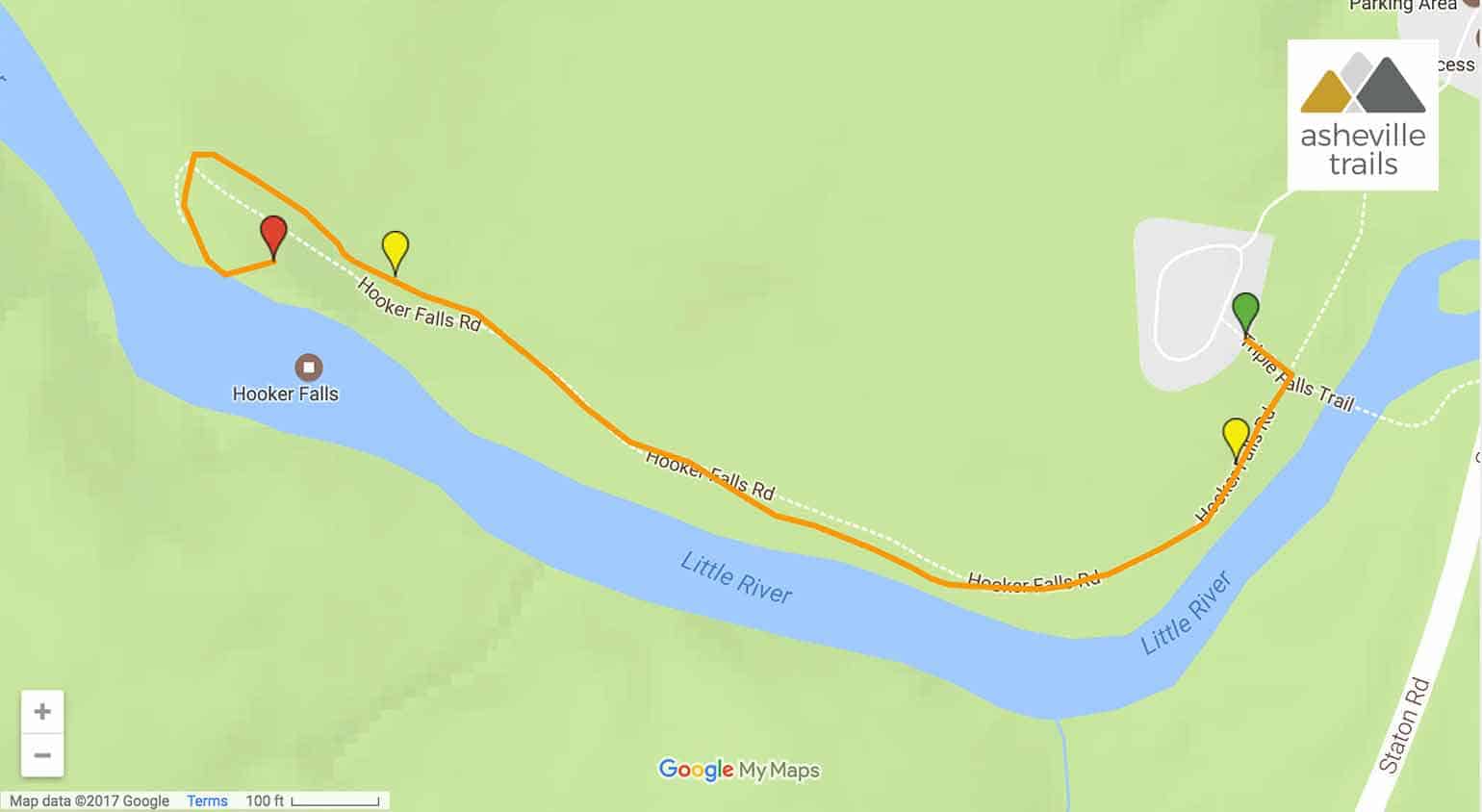
The hike begins at the large Hooker Falls / Triple Falls trailhead and parking area at Dupont State Forest (view maps and driving directions). At the trailhead, facing the bridge over the Little River, the hike departs to the right, walking southwest and following the river downstream.
The trail follows a wide gravel road, meandering along the river’s contours in a forest of rhododendron and hemlock. The Little River flows trailside, tumbling over a rocky bed littered with large stones and small boulders.

The hike reaches an overlook at .25 mile, catching a side view of the spilling falls. Hooker Falls cascades down a dozen feet from a level, stair-stepped cliff, tumbling onto a flat, level rock outcrop below.
The trail departs the overlook and continues its northwest journey, hiking to a wide, open area just below the falls. Large, level, blocky rocks with fractures filled with soft green grasses make a great place to hang out and enjoy the waterfall’s beauty.

After a quick dip, the hike retraces its outbound steps to the trailhead, completing the adventure at just over a half mile.
Note: slippery rocks and fast moving water can be extremely dangerous! Please don’t climb, stand on, swim above, or jump from any waterfall. And please pack out everything you packed in to help keep DuPont State Forest beautiful.

More waterfall hikes at DuPont State Forest
In the mood to chase some more beautiful waterfalls? From this same trailhead, cross the bridge to hike the Triple Falls Trail to a stunning trio of waterfalls that were a filming location for The Last of the Mohicans and The Hunger Games. Or, for even more waterfall-filled adventures, hike the DuPont State Forest Waterfalls Hike, visiting Hooker Falls, Triple Falls, and High Falls on the Little River.
And if you’re up for some more stunning views of cascades without a long hike, check out our favorite hikes to waterfalls near Asheville under two miles. They’re short on distance but big on beauty, and they’re great for beginners and families, too.

Please Remember
Always leave no trace, pack out everything you pack in, and if you see trash, pick it up and pack it out.
Stay on the marked trail, tell someone where you're going, pack safety and wayfinding essentials, and don't rely on a mobile phone to find your way. Please always practice good trail etiquette. And before you go, always check the trailhead kiosk, official maps, and the park or ranger office for notices of changed routes, trail closures, safety information, and restrictions.
Hooker Falls Trail at DuPont State Forest Map, Directions & Details
Love the trail?
This trail is maintained thanks to the hard work of countless volunteers and donations from supporters of the Friends of DuPont State Forest. Please support them by making a donation or joining a volunteer day. Let's work together to keep these fantastic trails maintained and open for use!
Driving Directions
Parking
Free parking is available at the trailhead. Check the DuPont State Forest website for hours and closures.
GPS Coordinates
35.202017, -82.620033 // N35 12.121 W82 37.202
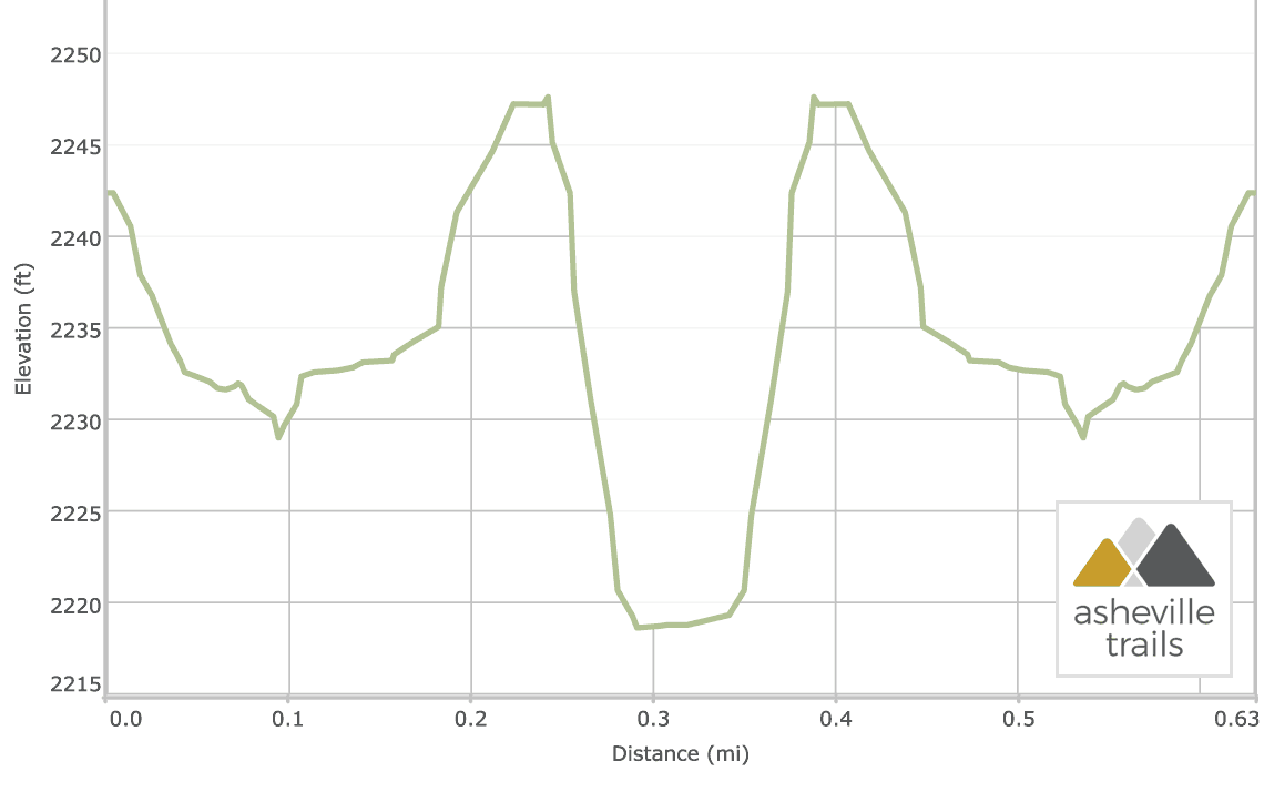
Elevation Profile